What does it mean?
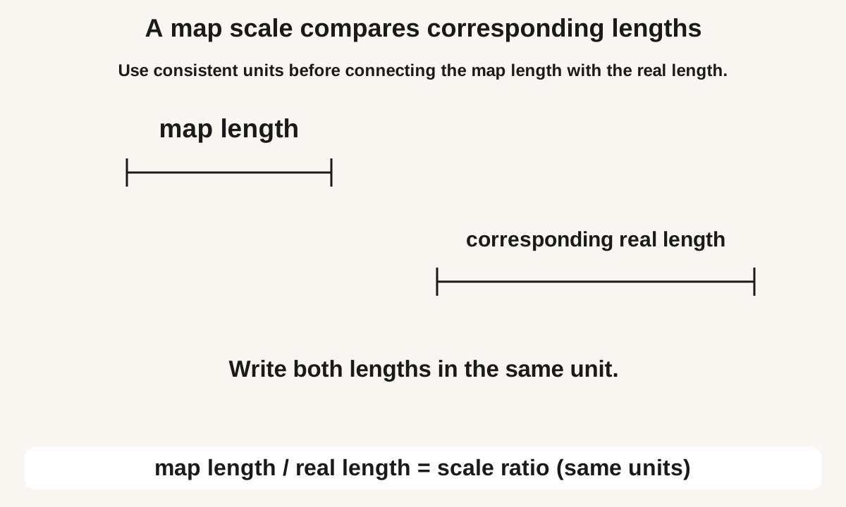
A scale compares corresponding distances in the same unit. On a 1 : 50,000 map, 1 cm represents 50,000 cm, or 0.5 km. A bearing describes direction instead: it is measured clockwise from north and written with three digits, such as 045°.
A scale compares corresponding distances in the same unit. On a 1 : 50,000 map, 1 cm represents 50,000 cm, or 0.5 km. A bearing describes direction instead: it is measured clockwise from north and written with three digits, such as 045°. For distance, multiply map length by the scale denominator, then convert units. For the reverse problem, convert the real distance to the map’s unit before dividing. For a bearing, draw a north line at the starting point and measure clockwise to the destination direction. East is 090°, south 180° and west 270°.
Learning goal: Produce and interpret scale drawings and selected constructions. The grade is a suggested starting point; school sequences vary. Use the first worked example to check readiness, and Grade 6 ratio and unitary method: word problems explained if an earlier idea needs revisiting.
See the idea
Read each diagram with its labels, then follow the worked examples. Practice questions include their own measurements and information.

Enlarge diagram to read the labels
Swipe across the enlarged diagram to read every label.
Enlarge diagram to read the labels
Swipe across the enlarged diagram to read every label.
Choose a method and explain why it works
For distance, multiply map length by the scale denominator, then convert units. For the reverse problem, convert the real distance to the map’s unit before dividing. For a bearing, draw a north line at the starting point and measure clockwise to the destination direction. East is 090°, south 180° and west 270°.
Notation: Scale 1 : n. Real = map × n (same unit). Perpendicular bisector: two equal-radius arcs.
Key rule and when to use it
For scale 1:n, real length = map length × n in matching units. Bearings are measured clockwise from north and written with three digits.
Worked examples, step by step
Example 1: A map has scale 1 : 50 000. A road measures 6 cm on the map. Find the real length in kilometres.
- 1 cm on the map is 50 000 cm in real life. Real length = 6 × 50 000 = 300 000 cm.
- 1 km = 100 000 cm, so 300 000 cm = 3 km.
- Check: 1 cm represents 0.5 km, so 6 cm represents 3 km.
Answer: 3 km
Check: Each centimetre is half a kilometre, so 6 cm is 3 km, not 6 km.
Example 2: Find the reverse bearing when B is on a bearing of 230° from A.
- A reverse direction differs by 180° in this plane-map model.
- 230° − 180° = 050°.
- The three-digit bearing of A from B is 050°.
Answer: 050°
Example 3: B is on a bearing of 070° from A. Find the bearing of A from B.
- This uses the plane-map model with parallel north directions.
- Add 180° to reverse the direction: 070° + 180° = 250°.
- The reverse bearing is 250°. For a starting bearing above 180°, subtract 180° instead.
Common mistakes and important boundaries
A bearing is measured at the starting point; the reverse journey starts elsewhere. In a plane map model with parallel north lines, reverse bearings differ by 180°, adjusted into 000° to less than 360°. A printed map resized by a printer can invalidate a stated ratio scale unless the scale is adjusted too.
A point to explain
A learner may multiply by n without matching units, or treat a sketch as already to scale.
Compare an uncertain attempt with the closest worked example. Look at the meaning of each operation, unit and label before repeating the arithmetic.
Map Scales and Bearings: Distance and Direction — practice
Work on paper first. Open each answer afterwards and compare the reasoning. Print the questions with or without the separate answer key; no account is required.
Name: ____________________ Date: __________
What does the scale 1 : 25 000 mean?
Answer and a way to check
1 cm on the map is 25 000 cm in real life.
Read 1 : n as 1 map unit to n of the same units in real life.
Scale 1 : 50 000. Map length 4 cm. Which is the real length in kilometres?
Answer and a way to check
2 km
4 × 50 000 gives centimetres. Divide by 100 000 to reach kilometres.
Scale 1 : 20 000. A path is 5 cm on the map. Find the real length in kilometres.
Answer and a way to check
1 km
Multiply 5 by 20 000. Then divide by 100 000.
Scale 1 : 25 000. A real footpath is 2 km. Find the map length in centimetres.
Answer and a way to check
8 cm
2 km = 200 000 cm. Divide by 25 000.
What is the three-digit bearing of east?
Answer and a way to check
090°
Measure clockwise from north; east is one quarter-turn, or 90°.
Why must a bearing name its starting point?
Answer and a way to check
The north line and direction angle are measured at that point.
Reversing the journey changes which north line and direction you use.
Scale 1 : 50 000. Map 6 cm. A student says the real length is 6 × 50 000 = 300 000 km. What is the mistake?
Answer and a way to check
The product 300 000 is in centimetres, not kilometres.
6 × 50 000 uses centimetres. Divide by 100 000 to name kilometres.
A map scale is 1 : 40,000. A path is 3 km long and travels on a bearing of 060°. Find the map length and reverse bearing.
Answer and a way to check
7.5 cm; 240°
3 km = 300,000 cm; divide by 40,000 to get 7.5 cm. Reverse the bearing by adding 180°.
Map Scales and Bearings: Distance and Direction — answer key
1 cm on the map is 25 000 cm in real life. Read 1 : n as 1 map unit to n of the same units in real life.
2 km 4 × 50 000 gives centimetres. Divide by 100 000 to reach kilometres.
1 km Multiply 5 by 20 000. Then divide by 100 000.
8 cm 2 km = 200 000 cm. Divide by 25 000.
090° Measure clockwise from north; east is one quarter-turn, or 90°.
The north line and direction angle are measured at that point. Reversing the journey changes which north line and direction you use.
The product 300 000 is in centimetres, not kilometres. 6 × 50 000 uses centimetres. Divide by 100 000 to name kilometres.
7.5 cm; 240° 3 km = 300,000 cm; divide by 40,000 to get 7.5 cm. Reverse the bearing by adding 180°.
Questions students and parents ask
How do I find a reverse bearing?
In the plane-map model, add 180° if the original bearing is below 180°; otherwise subtract 180°. Thus 075° reverses to 255°, and 230° reverses to 050°. Use 000° for north.
Why must I convert kilometres to centimetres in a reverse scale problem?
The ratio 1 : n compares like units. Dividing a kilometre number directly by a centimetre-based scale mixes units and gives a result of the wrong size.
Is this a complete set of textbook exercise solutions?
No. This guide adapts BananaLearn’s own teaching examples and practice. It is not official NCERT material or a promise of the exact chapter sequence in a particular board, country or textbook edition.
What if the examples are still difficult?
Revisit Grade 6 ratio and unitary method: word problems explained. Try the first example with its model, then attempt one fresh question independently. A correct copied answer is not evidence that the method can be used without support.
Help at home
Separate the two jobs: scale finds distance; bearing finds direction. Ask the learner to name the starting point before drawing the north line.
Keep one example of the learner’s own working. A repeated difficulty across fresh questions can guide a discussion with their teacher; one short practice sheet does not establish a diagnosis or a full mastery profile.
Connect this idea to the next skill
About this guide
Based on BananaLearn’s Grade 8 course lesson “Scale and Compass”. The explanations have been adapted for independent reading; course diagrams are reused where they fit the idea, and missing classroom givens are made explicit in questions.
Need another way to understand it?
Bring one question your child found difficult to a free 50-minute session. Tell us their grade, curriculum and time zone so we can discuss a suitable next step.
Request a free session